How To Get a Quote
***Online pricing not available, Please request a quote:***
How To Get A Quote:
Option 1:
“Contact Us to make sure you are getting the best unit possible. These machines are complex so let us help you get exactly what you need!
Option 2: (quickest response times)
Step 1. Add the item to your cart
Step 2. Checkout or Click on the Chat button box that is at the bottom right of your screen
Step 3. Please tell us any info you think we would need to know
Step 4. Relax, our team is processing your request and an expert will be in touch to get you exactly what you need!
Product Description
DJI Ground Station Pro | Drone Software | Mission Planning & Management
DESCRIPTION
Run automated flight missions, manage flight data on the cloud, and collaborate with other team members in your drone program.
Providing Effective Flight Data Management
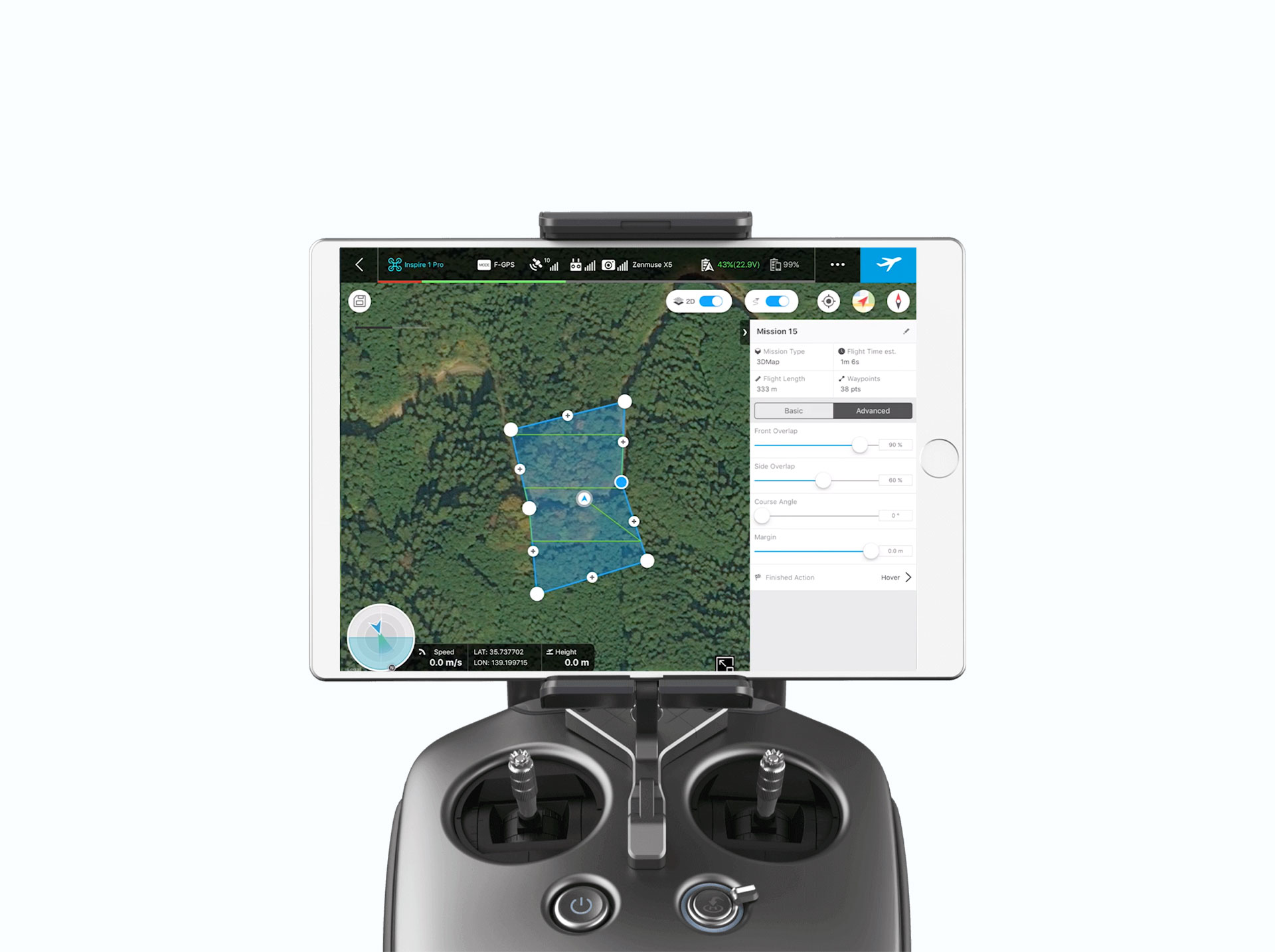
The DJI Ground Station Pro is an iPad-compatible app that allows your team to plan and conduct detailed mapping and aerial photography missions for compatible DJI aircraft. Mission planning is simplified with onscreen commands that activate pre-programmed functions.
The DJI GS Pro Serves Multiple Enterprises:
Agriculture
- Agricultural consultants who gather data for crop mapping, field analysis, irrigation measurements, nutrient evaluations, pesticides recommendations, and yield forecasts.
- Farmers who practice precision agriculture and rely on data analysis for fertilizer and pesticide application levels.
- Pesticide sprayers or surveyors and engineers who need geo-fencing to limit altitude or to avoid no-fly zones.
Public Safety
- Search-and-rescue operations that must limit flights to a predetermined area.
Inspection
- Electrical inspectors who need to establish precise flight paths simply and quickly, and must inspect towers and other tall structures or sprawling facilities.
- Communications personnel who must inspect and gather data on cell towers and suspended power lines.
- Inspectors who must make 3D maps of tall structures, such as buildings and monuments (with in-app purchase).
Real Estate
- Real estate developers, marketers and construction engineers who must make 3D maps of sprawling areas (with in-app purchase).
Construction
- Construction companies that must import KML/SHP files to maximize mapping accuracy and efficiency (with in-app purchase).
Other Businesses
- Mappers who must shoot multiple images of as many as 99 waypoints on a single mission.
- Any business that must program a drone to remain out of nearby restricted flight areas.
- Companies that need to convert aerial photo images into an accurate map (with in-app purchase).
How DJI GS Pro Works
Map fields in minutes to conduct stand counts, identify variability, and make in-field recommendations, all offline at the field's edge.
Demonstrate product performance across research and development, production, and commercial teams with field-edge mapping, multispectral processing, and automated stand counts. Reduce travel to the field by live streaming drone footage to teams around the world.
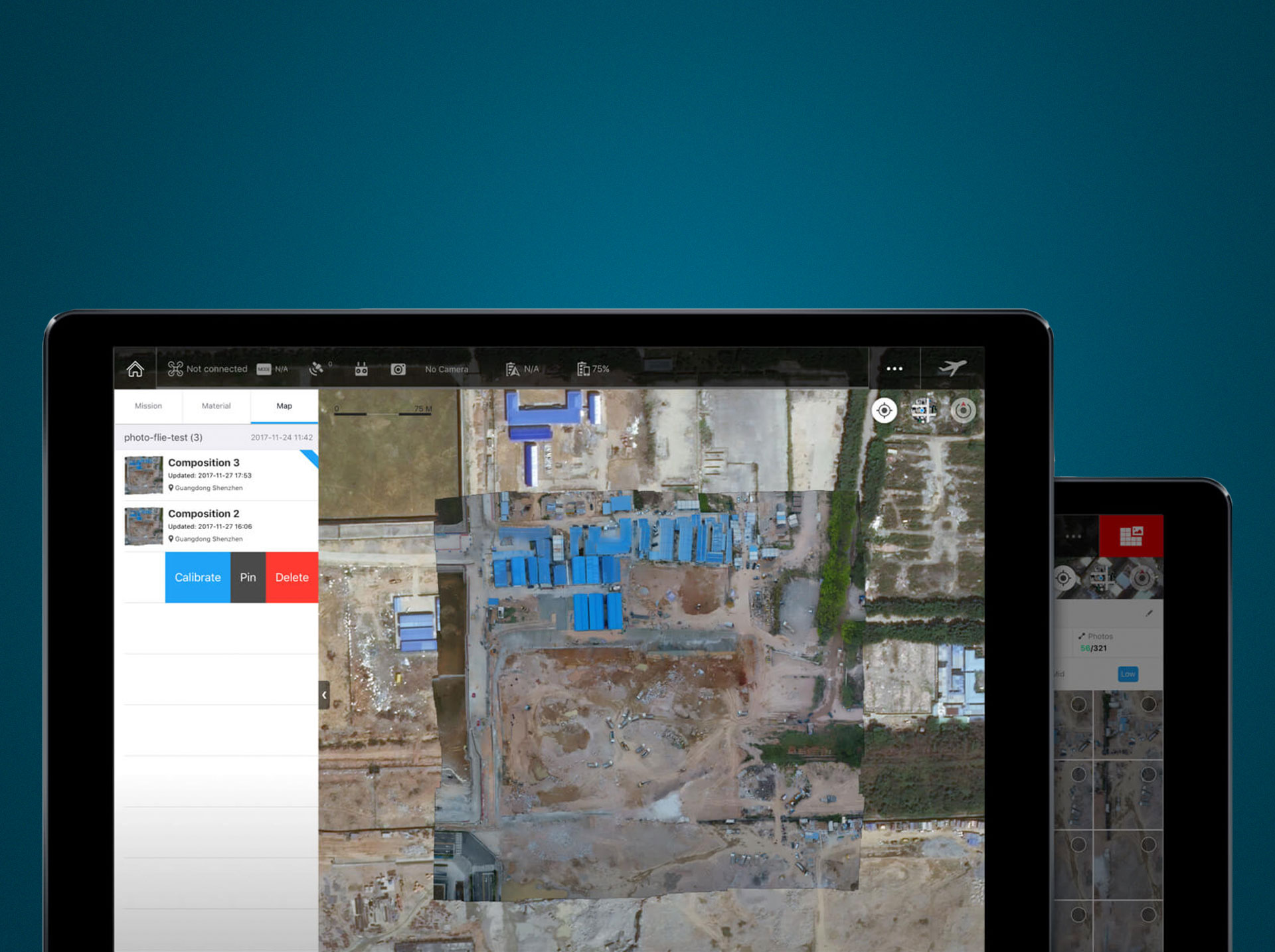
The app also helps to manage projects. Project managers can see their own flight records as well as those of others on their missions.
They can also see historical mission activities, duplicate mission settings, assign those settings to new projects, set flight parameters, and archive projects or remove them.
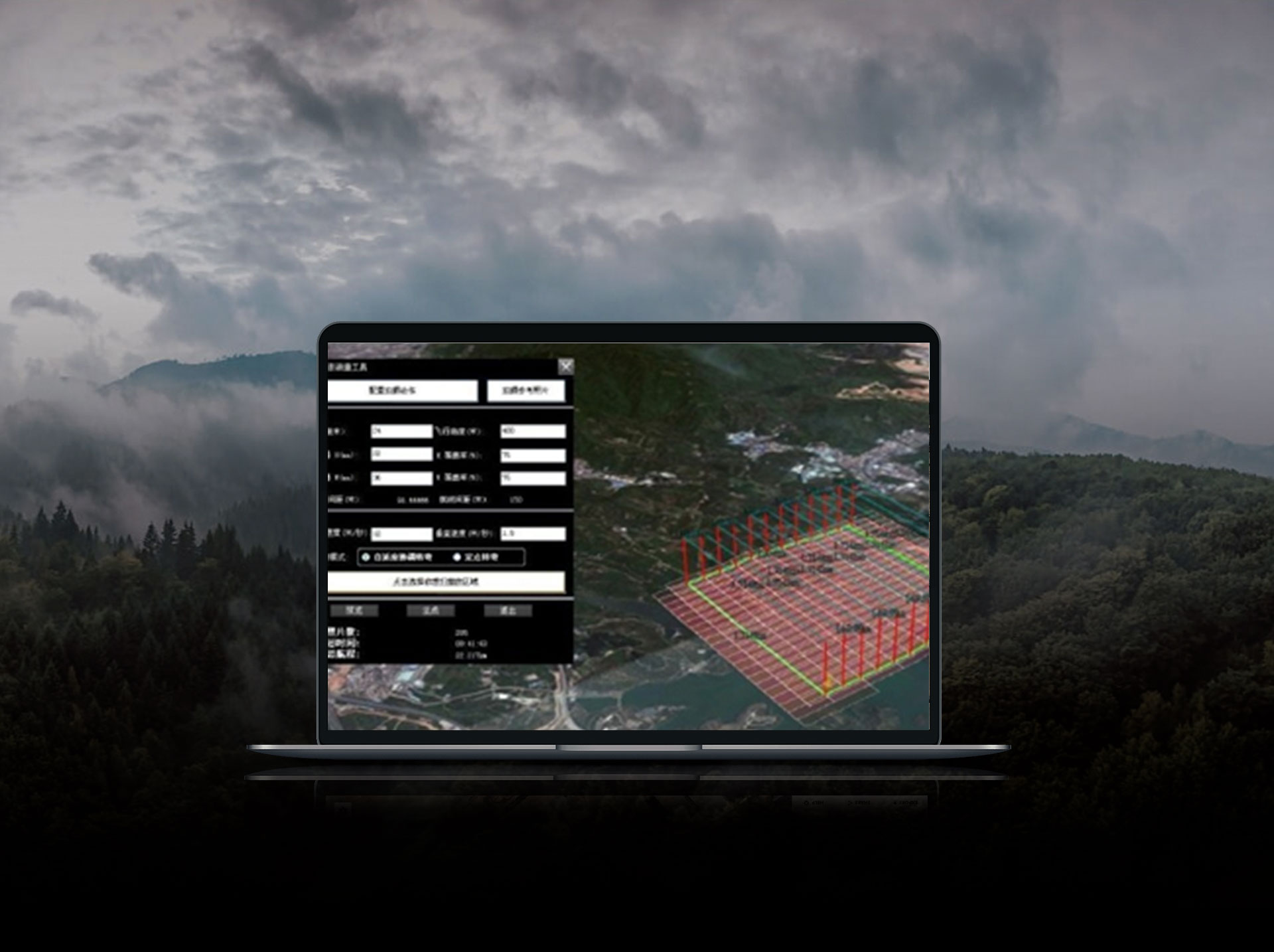
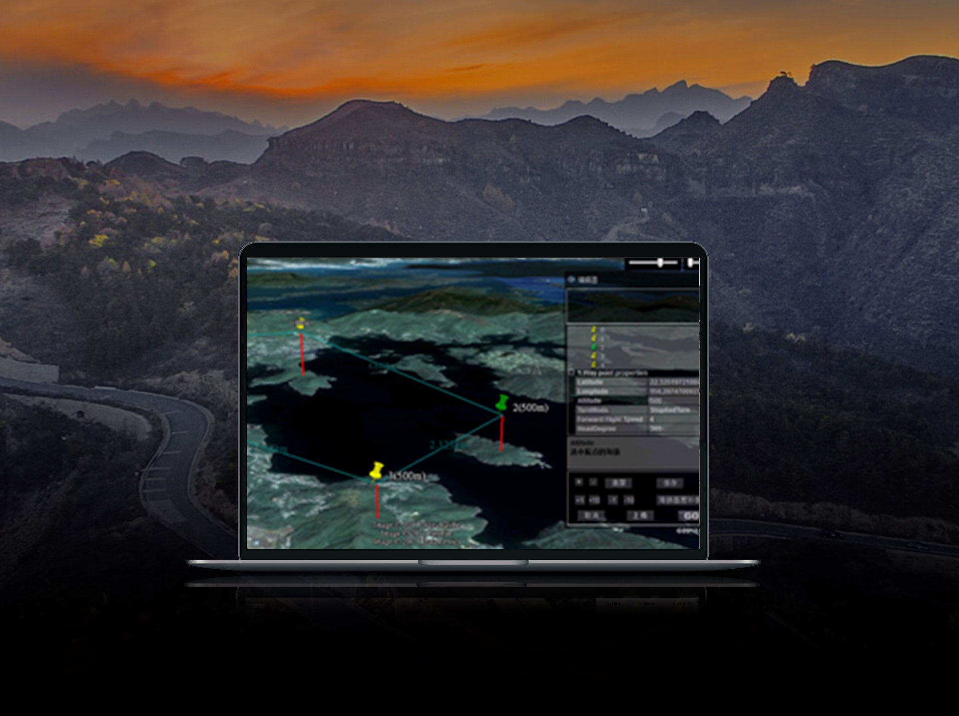
Flight and mission planning makes missions foolproof because once parameters are set, the aircraft will carry out its mission, even if contact is lost.
Entry of flight data is simple, including the definition of 3D map areas, parameters such as speed and altitude, overlaps, inside or outside scan modes. Even camera activity can be pre-programmed, along with procedures the aircraft should follow when the mission is complete.
Battery reserve is displayed, allowing the pilot to order a return to base if power runs low and a fresh battery is needed. Missions pick up where they left off once an aircraft is re-launched.
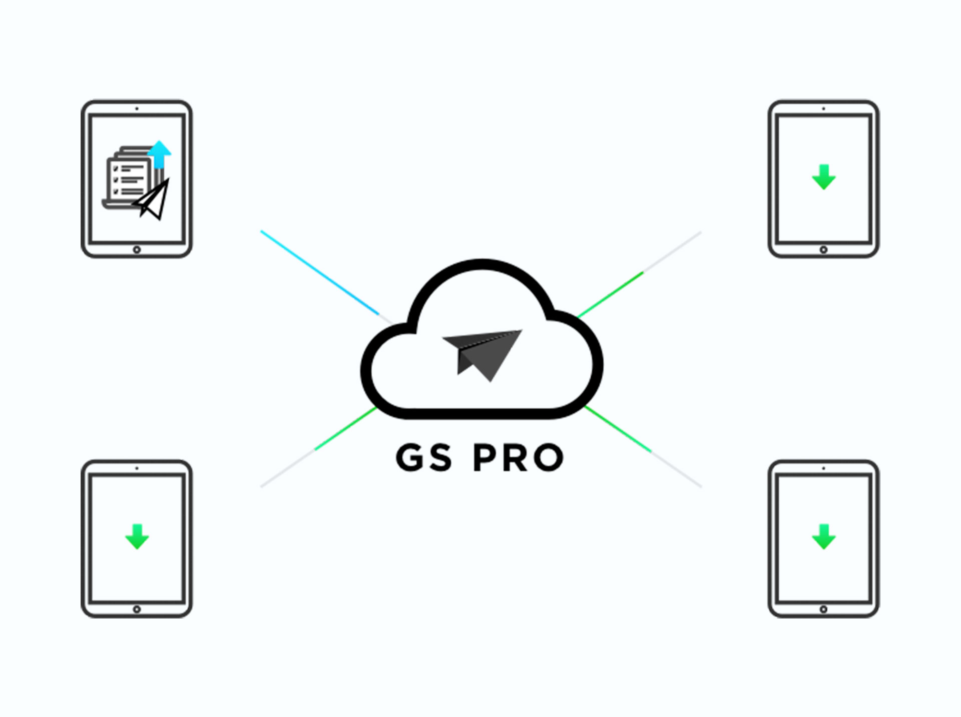
DJI Ground Station Pro stores all gathered data in the cloud.
This makes it easy to quickly and accurately retrieve information such as missions, clients, locations, dates, aircraft, pilots and flight logs. Team members can share and edit data.
- Optional In-App Functions
Available in-app programs add capabilities and further simplify operation.
In aerial mapping, for instance, overlaps are calculated automatically, and once a tall structure is identified, the app determines how and where the drone should fly — such as circling the subject from the optimum distance — to complete the mission.
Compatibility
DJI Ground Station Pro is compatible with a wide range of DJI drones, flight controllers, and cameras. GS Pro is not compatible with Android devices.
- Compatible Aerial Platforms and Flight Controllers:
Mavic 2 Enterprise, Mavic 2 Pro, Mavic 2 Zoom, Mavic Pro, Phantom 3 Standard/Advanced/Professional/4K, Phantom 4, Phantom 4 Pro, Phantom 4 Pro V2/Advanced, Phantom 4 RTK, Matrice 200 V2, Matrice 210 V2, Matrice 210 RTK V2, Matrice 210, Matrice 210 RTK, Matrice 100,Matrice 600/Pro, Matrice 200,
Inspire 1/Inspire 2, A3, N3.
Key Features
-
Mission Planning: Automate flight paths with pre-set waypoints and parameters for speed, altitude, and camera activity.
-
Aerial Mapping: Create high-precision 3D models and maps for analysis and reporting.
-
Cloud Storage: Access, edit, and share flight data seamlessly with team members.
-
Real-Time Operations: Monitor live battery levels, flight paths, and mission progress.
-
Enhanced Compatibility: Works with a variety of DJI drones, controllers, and cameras.
Detailed Specification
| Attribute |
Specification |
| Compatible Platforms |
Mavic, Phantom, Inspire, and Matrice series |
| Supported Controllers |
A3, N3, and others |
| Mapping Modes |
3D mapping, oblique mission planning |
| Data Management |
Cloud-based storage and retrieval |
| App Compatibility |
iOS (iPad only) |
| Mission Features |
Geo-fencing, real-time tracking |
| Optional Add-Ons |
Enhanced 3D mapping with in-app purchases |
Advantages
|
Managers can set operating parameters for teams and missions, keeping even inexperienced pilots on track.
|
Training demands are reduced because employees can easily program their drone or execute within parameters, and many existing drones already in fleet are compatible.
|
|
Drones linked to the DJI GS Pro are programmed to complete the mission, even when the control signal is interrupted or lost.
|
Menu-based programming of mission details and parameters is easy, with many traditionally complicated functions and calculations automated.
|
In Package
- 1x DJI Ground Station Pro Software License
- Access to mission planning and data management features
- Compatibility with a range of DJI drones and accessories
- Comprehensive user support and updates
Manuals & Documents
General Warranty Info:
- Ripping It Outdoors works closely with our manufacturers to supply and support your products warranty needs as best as possible!
- The majority of products come with a manufacturer represented warranty against manufacturing defects for at least a 12 month period after the date of sale.
- Expendable components and "wear parts" including but not limited to blades, knives, teeth, oil, chain sprockets, skid shoes, knife mounting discs, and similar components are usually excluded from manufacturer warranties.
- Please reach out to us for any specific warranty information needed about products and parts you can’t find!
Videos
Shipping
$1 Shipping Quote Info
-
Contact Us For Shipping Quotes. All $1 products are listed as quote only because we can not display their pricing online.
-
Low shipping rates for customers. We have negotiated the best possible rates for customers from our trusted carriers (ODFL, ESTES, UPS, and FedEx) & Top Private Drivers
-
Negotiate shipping rates if you think we can do better please reach out. Keep in mind some shipping rates also include assembly & configuration as well!
-
Complimentary lift gate service on all freight shipments where it’s possible. We guarantee safe delivery!